Huascaran (Photo from Wikipedia Commons)
We don’t always realize that a stage of our life is coming to an end. From 1967 to the early 80s I had been spending every available moment in the mountains and was pursuing a goal to do easy high altitude climbs. Two events changed everything: I met Mike, who would become my life partner, and I climbed Huascaran, the highest peak in Peru and the highest of my career.
Following a wonderful month-long trek over Inca trails, ending at Machu Picchu, I embarked on a month-long expedition to climb Huascaran with Mountain Travel. When I got home I discovered that my camera had malfunctioned; the loss of my photos was devastating. Nothing remains from the Inca trek, but fortunately our leader on Huascaran kindly sent me some excellent shots of our climbs, which I use here.
You don’t set off for 22,300 feet without first acclimatizing on some lower peaks. We camped in the valley seen far below, where a herd of cows destroyed one of our MSR stoves (the only MSR stove I have ever seen that was not field reparable). Was that an omen of our future troubles?
Next day we climbed this dry hillside to place a high camp.

Heading for our first climb.
Our expedition almost ended here. One of the guys (we were a party of 4) tried to burn his toilet paper, starting a wildfire that threatened to consume us. No camp ever came down so fast! We quite literally ran for our lives until we reached rocky terrain.

Fire on the hillside
The climb itself seemed anticlimactic, the most difficult part being the fiendishly steep dirt we had to surmount in order to reach a rock ridge.

Me on the rock ridge.
And what was our objective? This! We called it the Ice Cream Cake.

The “Ice Cream Cake”
Despite its appearance, the back side was an easy snow slope.
Our next climb was more challenging.

Approach to our next climb, seen in background.
Our intent was to place a high camp on the col and make the summit attempt from there.
Getting to the ridge involved a pretty spectacular glacier climb.

En route to high camp
Looking down to the location of our high camp I could also see the enormous challenge that awaited us on the morrow.

Setting up high camp
That night bad weather moved in, forcing us to retreat. We would need all our remaining time for our main objective.
Huascaran is a mountain steeped in tragedy. It has claimed many lives, only a few of them climbers; 20,000 people died in 1970 when an earthquake set off a massive landslide, burying the village of Yungay, and thousands more died in earlier slides. When we passed through Yungay we knew we were walking on a mass grave.
Getting to Huascaron base camp involved a long slog, but the view is worth it. We hid some gear there in what proved to be a vain hope that it would still be there on our return.

Huascaran base camp
The next few days saw sunshine and blue sky grace our route up heavily crevassed glacier, the warm rays offering some relief from the constant wind that threatened at times to stop us in our tracks. At one point an avalanche roared down toward us. We could see the cloud of snow approaching, but had no idea where the main body of the avalanche was. All we could do was drop into self-arrest position and hope. Fortunately all we got was a dusting of snow.

Easy going on the lower glaciers
Then the problems began. We had to pass beneath a giant icefall, where blocks of ice the size of a house lay all around us, dire evidence of what lay above. Climbing out of this area was fairly technical, but our leader provided a fixed rope.

Climbing through the icefall
Then the storm hit. One of those storms where you spend the night with feet and arms braced against the tent poles to keep the tent from collapsing. The storm lasted two days, and the only benefit was a relief from breakfasts of chicken noodle soup. For some reason, our leader did not believe in climbing on granola, but at least he had brought some, which we finished off pretty quickly, along with most of the candy we had.
When calm weather returned we continued. The scenery became increasingly spectacular.

Upper reaches of Huascaran
Our high camp was on one of the most awesome perches I have ever occupied.

High camp on Huascaran
Summit day. We ingest some chicken soup and head into and up the far side of the huge crevasse beside camp. We are already too high to move quickly as we slog up a long, steep snow slope, only to find our way blocked at the top by a crevasse. As we retrace our steps we see another party ascending, but they are to far away to warn. We later learn that they took a long fall on the way down and had to abandon their climb.
We take an alternate route, pausing briefly to eat a few yogurt-covered raisins. Then up and up as the day drags on. By late afternoon we are faced with a tough decision: the summit is in sight but still a long way off. If we turn around we will get back to camp before dark. If we keep going we risk being caught by darkness high on the mountain (as we are near the equator there will be no twilight). I feel strong and exhilarated, as I usually do at altitude, but I know that my brain is functioning oddly. Still I think, “I’ve come so far. I’ll never be back here again. Let’s go for it!” Did I persuade the others, or were they also thinking the same thing? We decide to keep going.
At last, the final slope.

The final slope
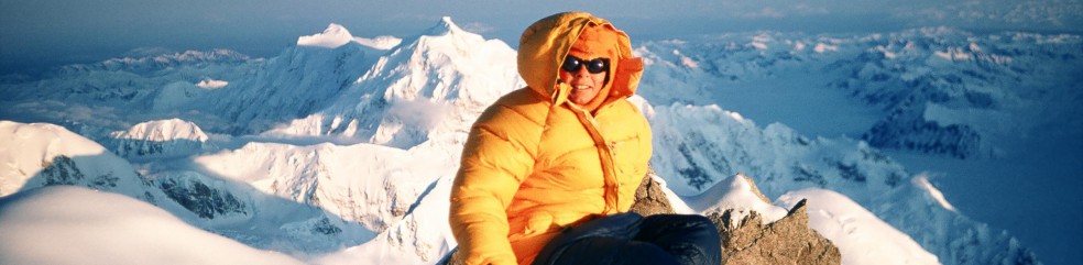
Success!

Summit
Yes, we got down. It was dark, but we managed to find the crevasse beside camp and stagger into our tents, too exhausted even to eat. We were the only party to reach the summit that week. When asked later how we got back to our tents, our leader said, “We flew.”
AFTERMATH
Ed Viesturs, one of the great Himalayan climbers, has said, “Getting down is not an option.” It’s a principle I had always followed in my climbing – until summit day on Huascaran. When I had time to reflect on the expedition, I realized that my brain was not working right at 22,000 feet. I had risked everything for what? Another summit? Objective dangers, like avalanches, icefalls and crevasses, are part of mountaineering. Bad decisions should never be.
There were other mountains as high or higher than Huascaran that were on my to-do list, but I knew that I should not attempt them. So, although I went on to do a few climbs near 19,000 feet, Huascaran became my farewell to high-altitude expeditions.
Indeed, after Huascaran I did a lot less climbing, not because I loved it less, but because in Mike, my life partner, I found a reason to spend more time at home. Mike enjoyed climbing, backpacking and skiing, but he had many other interests as well. For 25 years we shared adventures, mostly short trips that fit into his schedule, although we did go to Nepal and, in 1989, mount a private expedition to Baffin Island. It wasn’t until his death in 2006 that my passion for big, wilderness trips took over my life again and continues to rule it.